Hello everyone! And welcome to The Forest of Legends! Today’s topic is, like last time, maps! Today instead of modern maps, were going to be taking a look at some historical maps I have in store for you guys! Some I made, and some I found on the internet! Hope you guys enjoy!
Life Expectancy – 1915
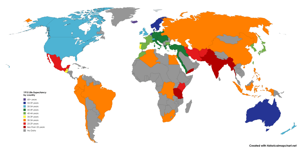
I know I did a life expectancy map last time, but I decided I wanted to do another one, just 110 years ago. I know not everything is accurate, like the fact that Montenegro and Serbia are still on the map, because they were taken over by Austria-Hungary in 1914.
Some stuff I was surprised on was Morocco’s and Guatemala’s life expectancy. They were both decently high for 110 years ago!
How long did these empires last?
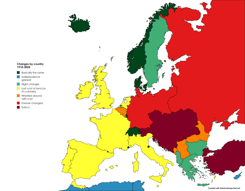
Now this map tells us how long each country lasted since 1910 with a almost identical or the same government system and land territories. Countries that remained the same (practically) would be Iceland, Luxembourg, Norway, Denmark, Sweden, and the other microstates. Meanwhile, Austria-Hungary and the Ottoman Empire are “extinct”, or gone from our existence (as of 2025).
Population map 1900 in millions
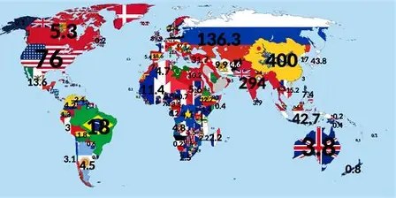
A simple map, but also complex at the same time. It gives out the population of each country, in millions. From my perspective, China is the most populous, followed by the British Raj, or India. That remained the same until 2023, I suppose!
Thank you, and make sure to like and subscribe for more!

Leave a comment